Groningen 1684
Nicolaes Visscher
Currently unavailable via Gallerease
- About the artwork
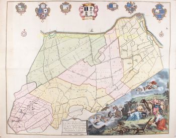
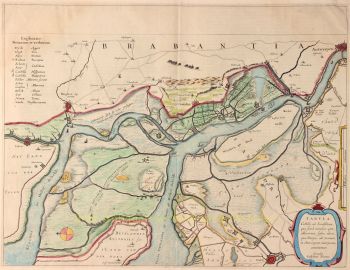
THE CITY AND LANE OF GRONINGEN "Groningae et Omlandiae Dominium vulgo de Provincie van Stadt en Lande", copper engraving made by A. Hogeboom, published by Nicolaes Visscher as part of his "Germania Inferior...". in 1684. Coloured by hand in time. Dim. 46 x 56 cm. Nicolaes Visscher II produced this map of the City and Country of Groningen together with the Wehe-born nobleman Ludolf Tjarda van Starkenborgh. Compared to earlier maps of the area, here and there small changes have been made. For instance, the settlements around Sappemeer have been depicted in more detail and the city of Groningen, surrounded by its seventeen dwellings, has been depicted more beautifully and topographically precise than before. The zijlen in the Old Provincial Dike have not been forgotten either, and furthermore, the map contains several abandoned houses and tollbooths. A number of lakes depicted by earlier mapmakers are named here, such as the Lijskemeer north of Bourtange and the lakes near Opwierde and Meedhuizen. Lakes have also been added and this is undoubtedly due to the progress of the peat extraction. In the south of Vredewold, Van Starkenborgh gives three moorings which in reality were much smaller and lay on a west-east, instead of a south-west-north-east line. They would disappear by draining, just like the Hoetmansmeer indicated near Wildervank. The nearby dykes point to systematic peat extraction along the Leekster Hoofddiep. The lake near De Punt mentioned here for the first time is not the Paterswoldse Meer or the Freische Veen. These would only come into being later in the Onland area north of Paterswolde. South of Woltersum two circles mark Wester- and Oostermeer. The Olderkerkerk Lake, now long gone and forgotten, is still marked. Like many other lakes it would disappear completely from the map in the 19th century due to drainage. Price: Euro 650,-
- About the artist
Nicolaes was the only son of Claes Jansz. Fisher. He is also known by the names: Nicolaas or Claes Claesz. After years of working for his father in the business, he succeeded him after his death in 1652. In 1662 he was admitted to the Amsterdam booksellers' guild and in 1677 Nicolaes, by now a respected publisher, received a 15-year patent from the states of Holland and West Friesland for the printing and publishing of maps. He died two years later and was buried in the same chapel as his father.
Atlas editions of Nicolaes I included:
"Atlas Contractus Orbis Terrarum" from 1657.
“Germania Inferior” from 1663.
“Atlas Minor” from 1675.
Visscher's atlases were often compiled according to the wishes of the buyers (the so-called Atlas Contractus). They generally contain no text, only sometimes a printed index. Cards from other makers were used, self-engraved and worked copper plates from his father.One of the highlights of seventeenth-century cartography is the multi-page wall map. An example of this - from 1656 - is the map of Zeeland: “Zelandiae Comitatus novissima Tabula”. This consisted of nine sheets that together had a size of 140 x 160 cm. By adding cityscapes, the map could be enlarged even further. These cityscapes were in turn published around 1668 under the name: “Speculum Zelandiae”.
Artwork details
Related artworks
- 1 - 4 / 5
- 1 - 4 / 24


