Groningen 1684
Nicolaes Visscher
Actuellement indisponible via Gallerease
- Sur l'oeuvre d'art
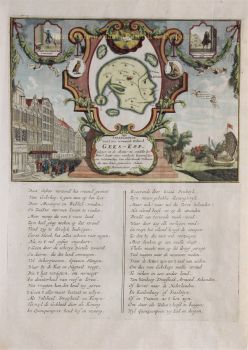
THE CITY AND LANE OF GRONINGEN "Groningae et Omlandiae Dominium vulgo de Provincie van Stadt en Lande", copper engraving made by A. Hogeboom, published by Nicolaes Visscher as part of his "Germania Inferior...". in 1684. Coloured by hand in time. Dim. 46 x 56 cm. Nicolaes Visscher II produced this map of the City and Country of Groningen together with the Wehe-born nobleman Ludolf Tjarda van Starkenborgh. Compared to earlier maps of the area, here and there small changes have been made. For instance, the settlements around Sappemeer have been depicted in more detail and the city of Groningen, surrounded by its seventeen dwellings, has been depicted more beautifully and topographically precise than before. The zijlen in the Old Provincial Dike have not been forgotten either, and furthermore, the map contains several abandoned houses and tollbooths. A number of lakes depicted by earlier mapmakers are named here, such as the Lijskemeer north of Bourtange and the lakes near Opwierde and Meedhuizen. Lakes have also been added and this is undoubtedly due to the progress of the peat extraction. In the south of Vredewold, Van Starkenborgh gives three moorings which in reality were much smaller and lay on a west-east, instead of a south-west-north-east line. They would disappear by draining, just like the Hoetmansmeer indicated near Wildervank. The nearby dykes point to systematic peat extraction along the Leekster Hoofddiep. The lake near De Punt mentioned here for the first time is not the Paterswoldse Meer or the Freische Veen. These would only come into being later in the Onland area north of Paterswolde. South of Woltersum two circles mark Wester- and Oostermeer. The Olderkerkerk Lake, now long gone and forgotten, is still marked. Like many other lakes it would disappear completely from the map in the 19th century due to drainage. Price: Euro 650,-
- Sur l'artiste
Nicolaes était le fils unique de Claes Jansz. Pêcheur. Il est également connu sous les noms : Nicolaas ou Claes Claesz. Après des années de travail pour son père dans l'entreprise, il lui succède après sa mort en 1652. En 1662, il fut admis à la guilde des libraires d'Amsterdam et en 1677, Nicolaes, désormais un éditeur respecté, reçut un brevet de 15 ans des États de Hollande et de Frise occidentale pour l'impression et la publication de cartes. Il mourut deux ans plus tard et fut enterré dans la même chapelle que son père.
Les éditions Atlas de Nicolaes I comprenaient:
"Atlas Contractus Orbis Terrarum" de 1657.
"Germanie inférieure" de 1663.
"Atlas mineur" de 1675.
Les atlas de Visscher étaient souvent compilés selon les souhaits des acheteurs (le soi-disant Atlas Contractus). Ils ne contiennent généralement pas de texte, seulement parfois un index imprimé. Des cartes d'autres fabricants ont été utilisées, auto-gravées et travaillées sur des plaques de cuivre de son père.L'un des points forts de la cartographie du XVIIe siècle est la carte murale de plusieurs pages. Un exemple de ceci - de 1656 - est la carte de la Zélande : « Zelandiae Comitatus novissima Tabula ». Il s'agissait de neuf feuilles qui, ensemble, avaient une taille de 140 x 160 cm. En ajoutant des paysages urbains, la carte pourrait être encore agrandie. Ces paysages urbains furent à leur tour publiés vers 1668 sous le nom de : « Speculum Zelandiae ».
Artwork details
Related artworks
- 1 - 4 / 5
- 1 - 4 / 24


