Nome: Petrus Kaerius / Pieter van den Keere / Pieter van der Keere
Pieter van den Keere nacque a Gand nel 1571, ma si trasferì a Londra nel 1584 a causa dell'occupazione spagnola con la sorella Coletta. Nel 1587 sposò il cartografo Jodocus Hondius, che divenne tutore di Pieter come editore e incisore.
Van den Keere lasciò Londra nel 1593 per stabilirsi ad Amsterdam, dove inizialmente lavorò come incisore per Hondius e in seguito divenne un editore indipendente.
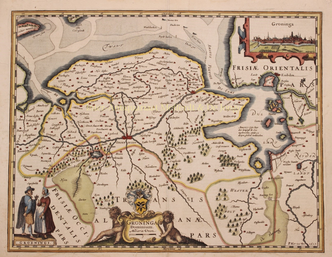
Nel 1595 pubblicò una grande mappa murale di 10 pagine dell'Europa, la Nova Totius Europae Descriptio. L'opera più nota di Petrus Kaerius, la Germania Inferior, fu pubblicata per la prima volta nel 1617.
Era un atlante incentrato esclusivamente sui Paesi Bassi, con un testo di accompagnamento di Petrus Montanus. Tuttavia, i tempi erano pessimi per gli incisori e all'inizio del 1620 van den Keere incontrò difficoltà finanziarie. Alla fine fu costretto a vendere le sue lastre di rame, così che Claes Janszoon Visscher, ad esempio, entrò in possesso delle lastre della Germania Inferiore.
Dal 1623 a Kaerius fu data l'opportunità di contribuire all'Atlante Minore da Hondius e tra il 1633 e il 1645 incise altre venti mappe dell'atlante per Janssonius.
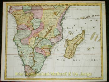
Importanza per la geografia: lo stesso Kaerius pubblicò alcune mappe, come la Great Wall Map of Europe (1595) e una World Map (1607). La sua opera più importante fu la Germania Inferior (1617). Questo è stato il primo atlante separato dei Paesi Bassi ed è stato pubblicato poco dopo anche in una versione francese e latina. Inoltre, è noto soprattutto per le numerose incisioni che ha realizzato per conto terzi.