Old map of the Holy Land  by Gerard and Cornelis de Jode
Scroll to zoom, click for slideshow

Old map of the Holy Land 1593

Gerard and Cornelis de Jode

CartaStampa
33 ⨯ 51 cm
€ 3.750

Inter-Antiquariaat Mefferdt & De Jonge

  • A proposito di opere d'arte
    16TH CENTURY PICTORAL MAP OF THE HOLY LAND “Descriptio et Situs Terrae Sanctae alio Nomine Palestina, Multis Preclaris Historys et Miraculis utriusque testamenti a Christo Salvatore nobilitata.” [The description and location of the Holy Land also called Palestine, famed for the many illustrious histories and miracles of both Testaments by Christ the Saviour.] Copper engraving published in 1593 by Gerard and Cornelis de Jode in the “Speculum Orbis Terrarum”. Coloured by a later hand. Size: 33,9 x 51,4 cm. The map shows the Holy Land oriented to the east, with its coastline from Tyrus to Gaza. The events of the Bible are depicted in words and illustrations. It locates the Twelve Tribes, the descendants of the biblical patriarch Jacob, who collectively form the Israelite nation. Gerard de Jode states in the tekst box in the lower left: Here you find, good reader, a compendious description of the entire land of promise from the book of Joshua and Ezekiel, indicating the regions, cities, mountains, and monuments worthy of being known, both old and new. The De Jode family (Gerardus, the father, and Cornelis, the son) from Antwerp, had the misfortune of attempting to compete in the atlas market with the formidable and well-connected Abraham Ortelius. The De Jodes were and are respected as mapmakers, as evidenced by this work based on then current sources, but they were no commercial match for Ortelius. They published a mere two editions of their atlas as opposed to approximately 40 by Ortelius. Hence, the considerable rarity of De Jode maps in today’s market. This map of the Holy land appeared in only the second edition of De Jode’s atlas, and is consequently even rarer. Price: Euro 3.750,-
  • A proposito di opere artista

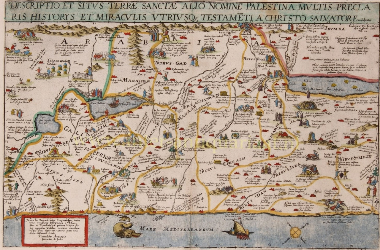
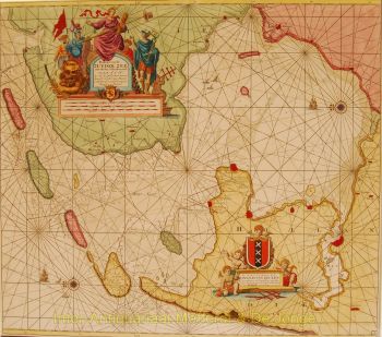
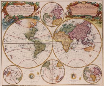
    Cornelis de Jode (Anversa, 1568 – Bergen, 1600) è stato un cartografo, incisore e stampatore dei Paesi Bassi meridionali. Cornelis era un figlio di Gerard de Jode.

    Si era preparato per il suo compito attraverso lo studio e si distinse come "plaetsnyder" ed editore. De Jode ebbe presto successo: la seconda edizione dell'atlante mondiale Speculum Orbis Terrarum ("Specchio dei paesi del mondo") del padre Gerard, ora ribattezzato Speculum Orbis Terrae ("Specchio del paese del mondo"), migliorata e ampliata da 65 a 109 carte, apparve nel 1593 e vendette molto meglio della prima. Nel 1595 Cornelis entrò a far parte della Corporazione degli artigiani di San Luca di Anversa.

    De Jode scrisse anche De Quadrante Geometrico Libellus (1594), 'Libro sul quadrante geometrico'. Secondo il suo epitaffio, Cornelis era uno dei cartografi piuttosto rari che avevano viaggiato molto: in Norvegia, Danimarca, Islanda, Italia e Spagna.

    Una morte prematura pose fine alla sua promettente carriera. Le lastre di rame entrarono in possesso dell'editore J.B. Vrients che ha acquistato anche i piatti di Ortelius. Tuttavia, non sono note edizioni simili dell'atlante di Vrients, solo una ristampa della mappa del Pool nel 1618.

Sei interessato ad acquistare questa opera d'arte?