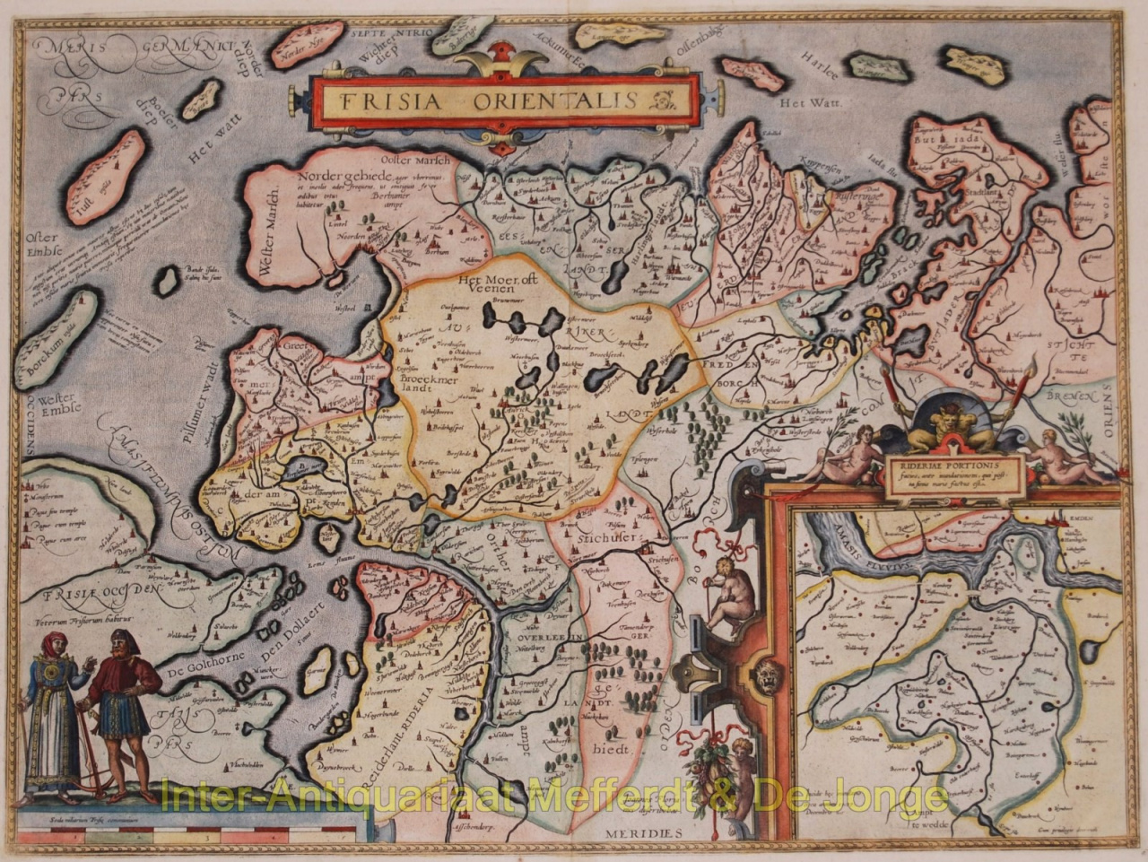
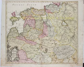
East Friesland, Ostfriesland - "Frisia Orientalis" Beautiful map of east Frisian islands and the northwestern tip of Germany. With people in local costumes. Nicely ornamented inset of the Eems estuary. Based on a manuscript map of Jan Bloemaert or Johannes Florianus. Published by Abraham Ortelius in Antwerp 1598. Coloured by a later hand. Verso: French text. Size: 37,7 x 50,2 cm. price: Euro1.100,- (excl. VAT/BTW)
Abraham Ortelius nasceu na Antuérpia em 1527. Ele foi um famoso cartógrafo e geógrafo do sul da Holanda. Ortelius foi o fundador do Atlas moderno e pode ser visto como um dos grandes geógrafos de sua época. A família de Ortelius é originária da cidade alemã de Augsburg. Em 1547, Ortelius atuou como coloridor de mapas na guilda de Saint-Lucas em Antuérpia. Ele viveu brevemente na Inglaterra e Liege após 1576 por razões políticas. Depois disso, ele voltou para Antuérpia, onde viveu até morrer em 1598
Você está interessado em comprar esta obra de arte?
We use cookies to provide statistics that help us give you the best experience of our site. By using this site without changing your cookie settings, you are agreeing to our use of cookies.