Antique map of South East Asia - Johannes Janssonius by Johannes Janssonius
Scroll to zoom, click for slideshow

Antique map of South East Asia - Johannes Janssonius 1630

Johannes Janssonius

Papier
39 ⨯ 50 cm
€ 1.850

Inter-Antiquariaat Mefferdt & De Jonge

  • Over kunstwerk
    A LANDMARK EARLY MAP OF SOUTHEAST ASIA, THE PHILIPPINES, AND AUSTRALIA “Indiae Orientalis Nova Descriptio.“ Copper engraving published by Johannes Janssonius (in English also known as Jan Jansson) in 1630. With original hand colouring. Size (plate mark): 39 x 50,7 cm. This edition of Johannes Janssonius’ map—first appearing in his “Appendix” in 1630—is celebrated for its excellent regional detail and its historical significance. It is notably the only Dutch printed map to record the 1606 discoveries of captain Willem Janszoon aboard the Duyfken, an expedition that led to the first recorded European landing on Australian soil, specifically on the west coast of Cape York Peninsula. In the early 17th century, the Dutch East India Company (VOC) was eager to expand its trade monopoly in the East Indies. In 1605, at the initiative of the VOC, Jan Willemsz Verschoor organized an expedition "to discover the great land of New Guinea and other eastern and southern lands." Willem Janszoon (1570-1636) was selected for this pioneering expedition, setting sail from Bantam (Indonesia) in late 1605. According to John Saris, an agent for the British East India Company, the Duyfken departed on November 28, 1605. In early 1606, after navigating New Guinea’s south coast, Jansz sailed south across Torres Strait—mistaking it for a shallow bay—and continued along what he presumed was the continuation of New Guinea’s coastline. In truth, he was venturing into the waters off the Australian coast. Unbeknownst to him, this voyage marked the first recorded European encounter with Australian soil. In addition, the map also presents the Philippines in detail for the first time. Janssonius drew upon the work of VOC cartographer Hessel Gerritsz, utilizing information that the VOC had strictly controlled in the early 17th century for competitive reasons. Janssonius’ map is significant not only for its depiction of the discoveries in New Guinea, referred to as “Duyfkens Eylant,” but also as the sole printed cartographic record of part of the Duyfken’s route until later maps emerged. While the map uses a scale of miles to cover the area of the Australian discoveries—thus offering less detail on Jansz’s Australian findings—it remains an invaluable document in the history of European exploration in the region. Price: Euro 1.850,- (incl. frame)
  • Over kunstenaar

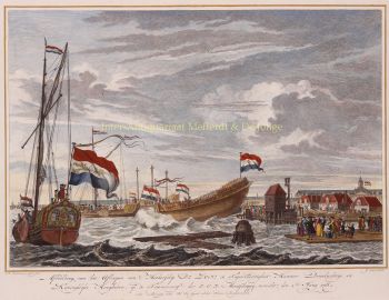
    Janssonius werd geboren in Arnhem als zoon van Jan Jansz, een drukker en uitgever aldaar. Op jonge leeftijd verhuisde hij naar Amsterdam, het toenmalige centrum van de boekdrukkunst- en kaartenhandel. In 1612 trouwde hij met Elisabeth Hondius, dochter van Jodocus Hondius. Elisabeth overleed in 1627 en Janssonius hertrouwde in 1629 met Elisabeth Carlier. Hij ging werken voor zijn schoonvader en zette na diens dood samen met Henricus Hondius (zoon van) de uitgeverij voort. Deze werd uitgebouwd tot een der grootste van die tijd. Er waren vestigingen in onder andere Berlijn, Frankfort, Genève, Lyon en Stockholm.

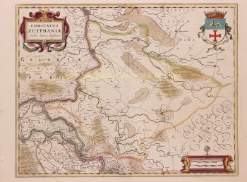
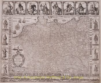
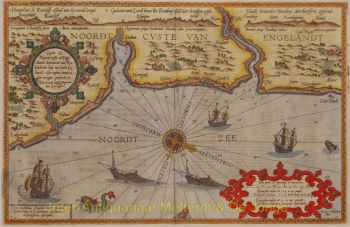
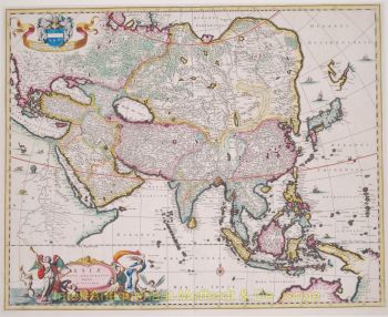
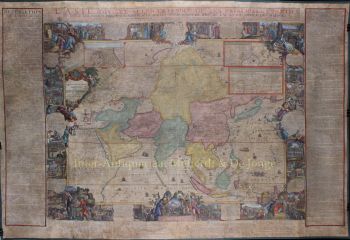
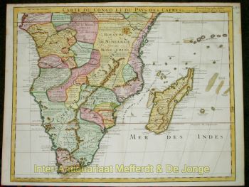
    Onder Janssonius' leiding werd de Mercator-Hondius Atlas uitgebreid en gepubliceerd als Atlas Novus. Deze, aanvankelijk uit één deel bestaande uitgave werd spoedig een uit meerdere delen bestaande atlas, op verzoek aangevuld met zeekaarten en/of hemelkaarten. Er waren uitgaven in het Nederlands, Frans, Spaans en Latijn. Net als zijn tijdgenoten maakte ook Janssonius gebruik van bestaande koperplaten, onder andere uit de stedenboeken van Braun & Hogenberg en de Description de touts les Pays Bas (Beschrijvinghe van alle de Neder-Landen) door Lodovico Guicciardini - (Cornelis Claesz. editie) uit 1609. Alhoewel Janssonius vaak is beschuldigd van het kopiëren van werk van Willem Blaeu mag opgemerkt worden dat er ook kaarten van Janssonius eerder op de markt verschenen.

    Na Janssonius' dood werd de firma voortgezet door zijn schoonzoon, Johannes (Jan) van Waesbergen, die gehuwd was met zijn dochter Elisabeth Janssonius (1615-1681). Veel koperplaten van de stedenboeken werden (soms lichtelijk aangepast) gebruikt door Frederik de Wit. Het pand op de Dam werd verhuurd aan Gerard Valck; ook een aantal drukplaten zijn in 1694 door hem opgekocht.

Bent u geïnteresseerd om dit kunstwerk te kopen?