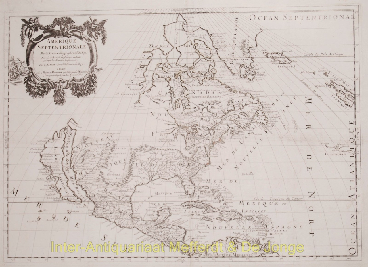
ONE OF THE EARLIEST MAPS TO DEPICT ALL 5 GREAT LAKES - Amerique SeptentrionaleAll of North America, with California depicted as an island. Engraved by Pierre mariette, published by Nicolas Sanson in 1659. First map to name Lakes Superior and Ontario. Burden calls this a "landmark map of North America. It was drawn, with his usual care, using the sinusoidal projection which is sometimes known by the name Sanson-Flamstead. It is, perhaps, most important for being the first printed map to delineate the five Great Lakes in a recognizable form... To the west, S Fe, Navajo, Apache, Taosij and others all appear for the first time. The first is incorrectly placed on the west bank of the Rio Grande, here again flowing to the south-west. These were the first advances in the geography of this region for some time. The information was derived from the travels of Father Alonso de Benavides in the late 1620's... California as an island is of the Briggs type with some important alterations; Sanson introduces four placenames from the de Laet map of 1630, C. de Fortune, C. de Pinos, C. de S.Martin and C. de Galera..." There were three states of the map, of which this is the third. The first state, of which only two examples were known, had no land to the north-west of California; the second state, also quite uncommon, added coastline at that point, and eliminated a few placenames north of California; the third state is the same as the second, except that Lake Ontario has been shaded to match the other Great Lakes. Size: 39,8 x 57 cm. Literature: Philip Burden, The Mapping of North America (1996), nr. 294 Price: Euro3.350,- (excl. VAT/BTW)