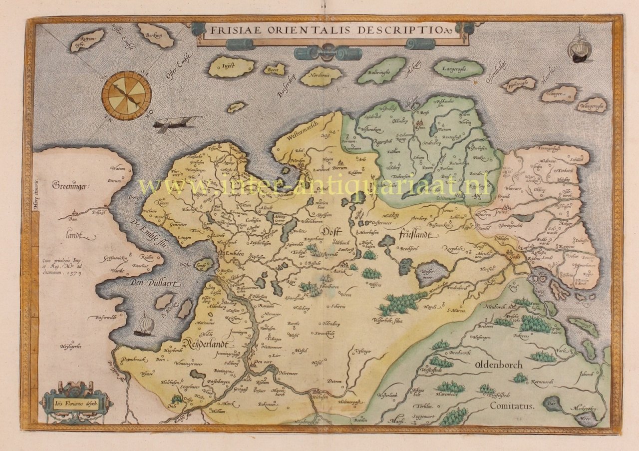
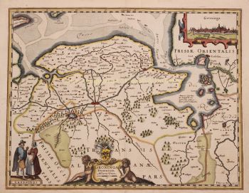
Abraham Ortelius (1527–1598) was a Flemish cartographer and geographer who is widely regarded as the creator of the first modern atlas and one of the most influential mapmakers in history. His groundbreaking publication, Theatrum Orbis Terrarum (Theatre of the World), marked a turning point in the way geographical knowledge was collected, standardised and presented.
First published in 1570, Theatrum Orbis Terrarum was revolutionary in both concept and execution. Unlike earlier collections of maps, Ortelius’s atlas offered a coherent and systematic overview of the known world, with maps of uniform size, style and quality, accompanied by scholarly commentary. This approach transformed cartography from a fragmented craft into a structured scientific and cultural discipline, making global geography accessible to scholars, merchants and statesmen alike.
Ortelius lived and worked during the Golden Age of Netherlandish cartography, a period in which advances in exploration, printing and trade reshaped Europe’s understanding of the world. Alongside Gerardus Mercator, Ortelius is considered a founding father of the Netherlandish school of cartography. While Mercator revolutionised map projection, Ortelius excelled in synthesis—bringing together the best available geographical knowledge into a single, authoritative work.
Beyond his technical achievements, Ortelius was a humanist thinker with a deep interest in history, classical antiquity and cultural exchange. He maintained an extensive international network of scholars, explorers and mapmakers, carefully crediting sources—an unusual and progressive practice for his time. This scholarly integrity contributed significantly to the credibility and enduring influence of his work.
Abraham Ortelius’s legacy lies not only in his maps, but in his vision of the world as an interconnected whole. His atlas shaped European worldviews for generations and laid the foundations for modern cartography, securing his place as one of the great intellectual figures of the Renaissance.