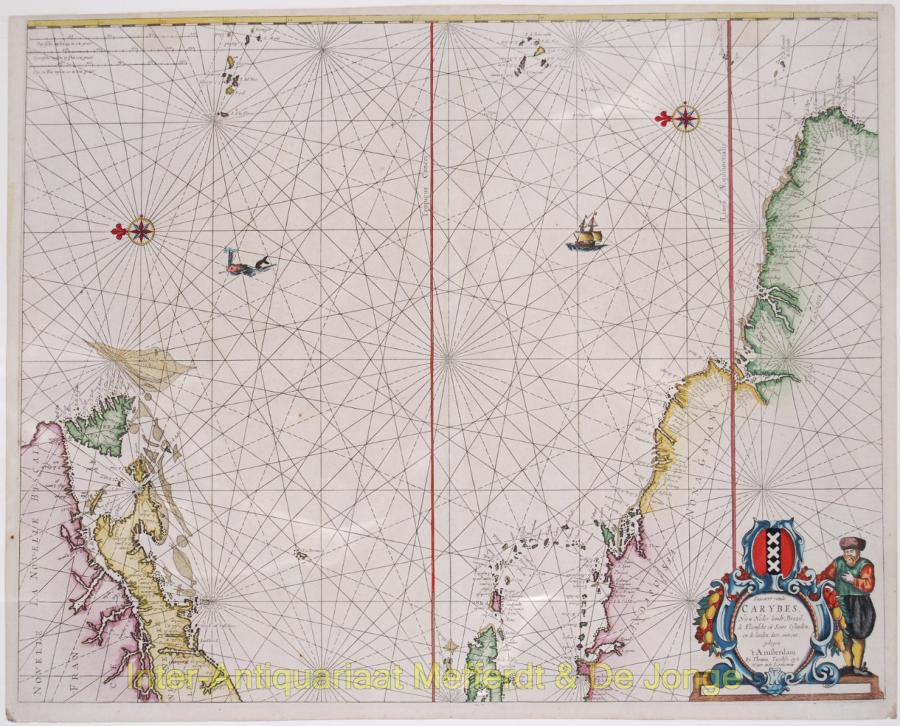
SEA CHART OF THE CARIBBEAN "Pascaert van de Carybes, Nieu Nederlandt, Brazil, de Flaemsche en Soute Eylanden ende landen daer omtrent gelegen." Copper engraving published by Theunis Jacobsz Lootsman in Amsterdam 1666. This progenitor chart covers the American shores of the Atlantic Ocean. The objective of the map was to present in atlas form the most desirable information from the "West Indische Paskaert" maps of Willem Blaeu. These charts had previously been sold as loose sheets. To accomplish this, Theunis Jacobsz concentrated on the waters between the Cape Verde islands and Azores, and removed the Gulf of Mexico. New Amsterdam is identified on the map as "Amsterdam". The map is decorated with the family emblem of a sailor holding a lead and line, and the official coat of arms of the Dutch West India Company. This chart was copied by Colom, Doncker, Goos, De Wit and others. Literature: Koeman IV, p. 223-226, Jac 1; Burden 298 Price: Euro1.350,- (excl VAT/BTW)