The city of Delft in 1649 by Joan Blaeu
Scroll to zoom, click for slideshow

The city of Delft in 1649 1649

Joan Blaeu

TintaPapelImprimir
48 ⨯ 57 cm
€ 1.850

Inter-Antiquariaat Mefferdt & De Jonge

  • Sobre arte
    THE CITY OF DELFT "Delfi Batavorum vernacule Delft", copper engraving, published in Amsterdam by Joan Blaeu in 1649. Size (print) 37,7 x 48,5 cm. Coloured by a later hand. Verso: Latin description of Delft. Until the 17th century, Delft was one of the major cities of Holland. Already in 1400, the city had 6500 inhabitants and was the third largest in size, after Dordrecht (8000) and Haarlem (7000). In 1560 Amsterdam with 28,000 inhabitants had become the largest city, followed by Delft, Leiden and Haarlem, each of which had about 14,000 inhabitants. In the 17th century, Delft experienced a new heyday. A Chamber of the VOC was established in Delft. The city sent a fleet to Southeast Asia three times a year, importing spices, Chinese porcelain and other luxury goods. The tradition of Delftware originated from the import of Chinese porcelain, with an extensive pottery industry. During the Eighty Years' War, Delft became a center of resistance against the Spanish, after several cities and territories managed to evade Spanish authority in the 1570s. Prince William of Orange briefly resided in Delft, in the former Sint-Agatha monastery, which has since been called Prinsenhof. After William of Orange was declared an outlaw by King Philip II, he was also murdered there by Balthasar Gerards in 1584. William of Orange is buried in the Nieuwe Kerk, clearly visible on the map on the market square. After William of Orange, 45 members of the House of Orange and the House of Orange-Nassau were buried in the royal crypt. This map was published after the Peace of Münster (1648) as part of Joan Blaeu's town book of the Netherlands "Novum Ac Magnum Theatrum Urbium Belgicae Liberae Ac Foederatae". The Amsterdam cartographer and publisher Joan Blaeu set himself the task of simultaneously achieving the objectives of Abraham Ortelius (famous for the publication of the first modern atlas in 1578) and Georg Braun and Franz Hogenberg (known for their town book published at the end of 1600): a multi-volume world atlas added by a number of town books. The town book of the United Netherlands was published in a Latin edition in 1649; the Dutch edition was printed in 1652. Some of the maps included in this work had already been published in older maps, other maps were made entirely new for Blaeu's town book. Price: Euro 1.850,-
  • Sobre artista

    Joan Blaeu (1596-1673), nasceu em 23 de setembro de 1596 em Alkmaar.

    Ele era um cartógrafo holandês nascido em Alkmaar. Ele seguiu os passos de seu pai, o cartógrafo Willem Blaeu.

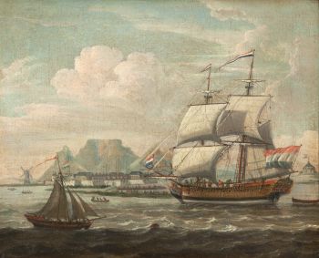
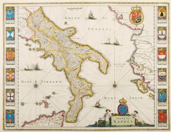
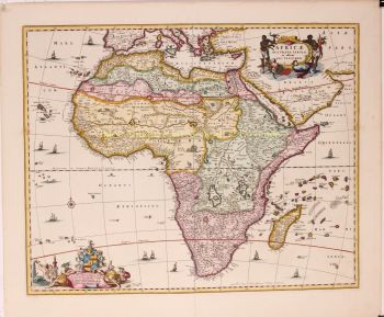
    Em 1620 tornou-se doutor em direito, mas ingressou no trabalho de seu pai. Em 1635 publicaram o Atlas Novus (título completo: Theatrum orbis terrarum, sive, Atlas novus) em dois volumes. Joan e seu irmão Cornelius assumiram o estúdio depois que seu pai morreu em 1638. Joan tornou-se o cartógrafo oficial da Companhia Holandesa das Índias Orientais.

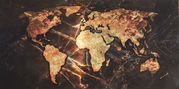
    O mapa-múndi de Blaeu, Nova et Accuratissima Terrarum Orbis Tabula, incorporando as descobertas de Abel Tasman, foi publicado em 1648. Este mapa foi revolucionário porque "descreve o sistema solar de acordo com as teorias heliocêntricas de Nicolau Copérnico, que mostram a Terra girando o sol... Embora o livro inovador de Copérnico Sobre as Revoluções das Esferas tenha sido impresso pela primeira vez em 1543, pouco mais de um século antes, Blaeu foi o primeiro cartógrafo a incorporar essa revolucionária teoria heliocêntrica em um mapa do mundo."

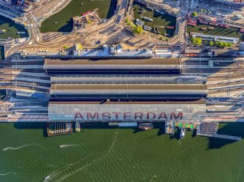
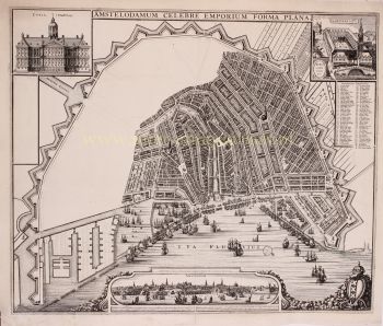
    O mapa de Blaeu foi copiado para o mapa-múndi colocado na calçada do Groote Burger-Zaal da nova Prefeitura de Amsterdã, projetado pelo arquiteto holandês Jacob van Campen (agora Palácio Real de Amsterdã), em 1655.

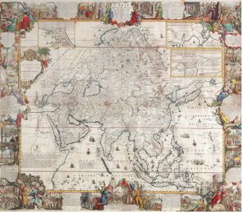
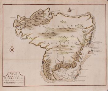
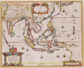
    A Hollandia Nova de Blaeu também foi retratada em seu Archipelagus Orientalis sive Asiaticus, publicado em 1659 no Kurfürsten Atlas (Atlas do Grande Eleitor). e usado por Melchisédech Thévenot para produzir seu mapa, Hollandia Nova—Terre Australe (1664).

    Como "Jean Blaeu", ele também publicou o volume 12 "Le Grand Atlas, ou Cosmographie blaviane, en laquelle est exactement descritte la terre, la mer, et le ciel". Uma edição é datada de 1663. Era fólio (540 x 340 mm) e continha 593 mapas e placas gravadas. Em março de 2015, uma cópia estava à venda por £ 750.000.

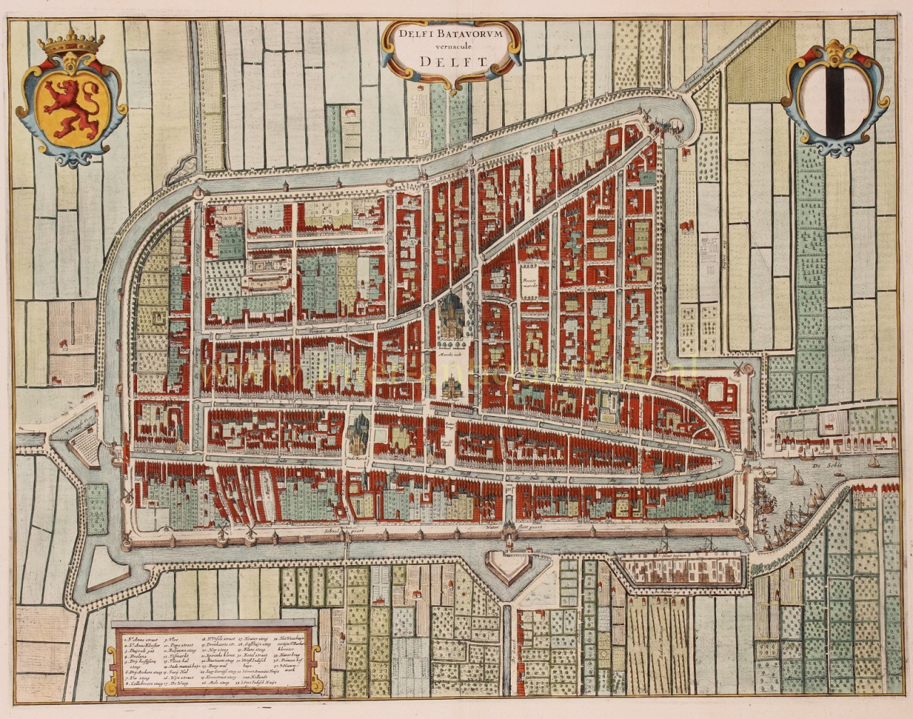
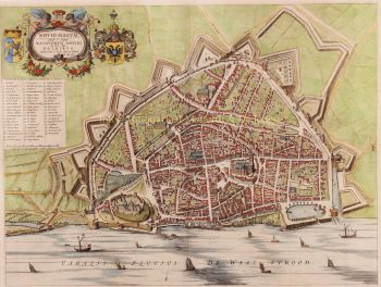
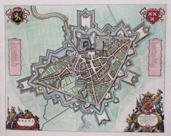
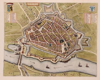
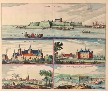
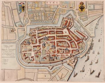
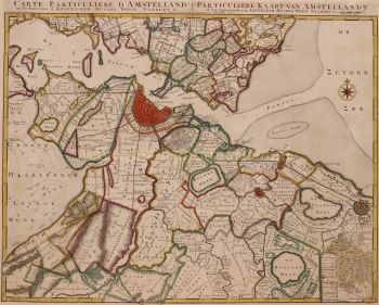
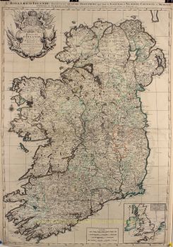
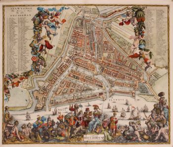
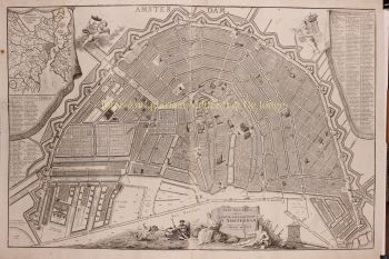
    Por volta de 1649, Joan Blaeu publicou uma coleção de mapas de cidades holandesas chamada Toonneel der Steeden (Visões de cidades). Em 1651 ele foi eleito para o conselho de Amsterdã. Em 1654, Joan publicou o primeiro atlas da Escócia, elaborado por Timothy Pont. Em 1662 reeditou o Atlas Novus, também conhecido como Atlas Maior, em 11 volumes, sendo um para os oceanos.

    Uma cosmologia foi planejada como seu próximo projeto, mas um incêndio destruiu o estúdio completamente em 1672.

    Joan Blaeu morreu em Amsterdã no ano seguinte, 1673. Ele foi enterrado no Westerkerk em Amsterdã.

Você está interessado em comprar esta obra de arte?

Artwork details